Local Birding
|
Emiquon National Wildlife Refuge
| Directions |
- From the intersection of SR (State Route) 78/N Main St. and SR 9/W
Locust St. in Canton, follow SR 78 south out of Canton 10.9 miles.
- Turn west (right) on US 24/SR 78 and go 3.1 miles.
- Turn south (left) on SR 78/SR 97 for 6.1 miles to the Emiquon National
Wildlife Refuge parking area on the left.
eBird:
Birding
Hotspot Map
(Note: this is just west of Havana) |
| Description |
Derived from an Indian name for “spoon,” Emiquon refers to the historic plethora
of freshwater mussels within this region of the Illinois River, the shells of
which were used as spoons by early Native Americans.
Emiquon National Wildlife Refuge (NWR) represents a massive effort undertaken
by the U.S. Fish & Wildlife Service and other partners in restoring and managing
native habitats throughout the backwaters and floodplain of the Illinois River.
Historically, the middle reaches of the Illinois River's floodplain supported a
vast mosaic of clear, shallow lakes, sloughs, bottomland hardwood forests, and
tallgrass prairies.
Additional Information |
| Suggested Route/Stops |
Perhaps the best introduction to the Emiquon National Wildlife Refuge would
include a hike down the Frank C. Bellrose Nature Trail. There, not only birds
and butterflies, but also mammals such as Striped Skunk, Raccoon, Opossum, and
White-tailed Deer may be spotted along the trail.
|
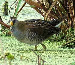
| Commonly Seen Birds |
Spring/Fall -- Visitors equipped with spotting scopes should carefully
scan these newly-flooded lands for sandpipers and other shorebirds, especially
during spring and fall migration periods.
Winter -- Likewise, ducks and other waterfowl make use of the refuge
during the winter months. Over 250 species have been documented on eBird. |
|
Specialties
|
Information; Hiking; Canoeing; Fishing; Viewing Platform; Picnic
|
|
|